McDowell County Genealogy
- Formed 1842
- Parent county / earlier Burke, Rutherford
- County seat Marion
- Neighbors Burke, Rutherford, Buncombe, Yancey, Avery, Mitchell
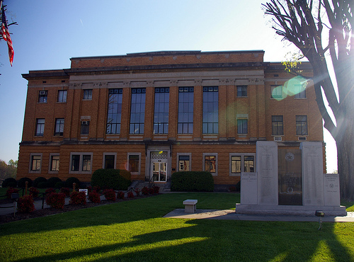
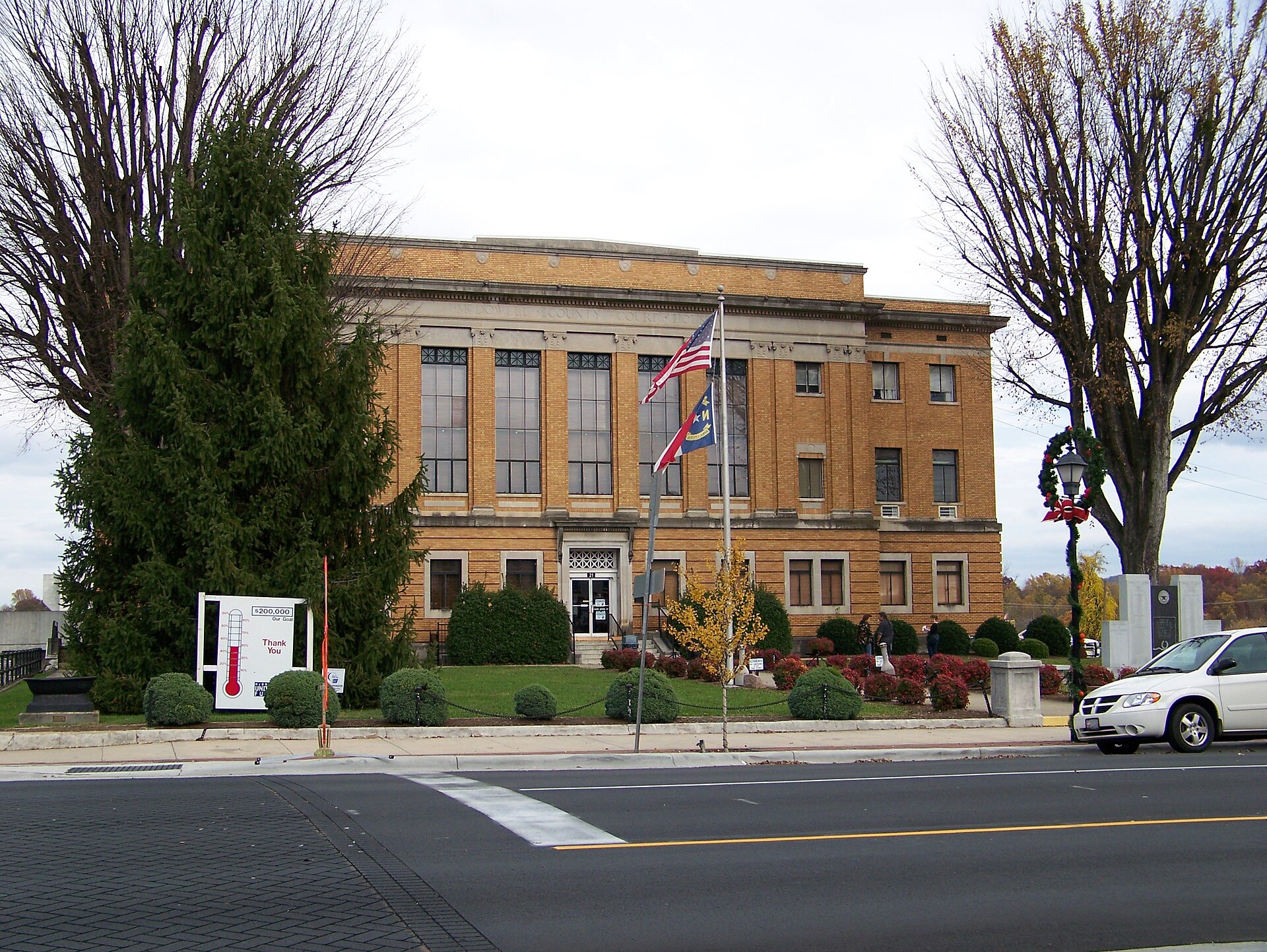
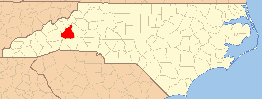
Photos & maps
What’s new
- Flagship hub: Marion foothills gateway west.
- Formation 1842 from Burke, Rutherford — for pre-formation events, use the parent jurisdiction’s paper (not later Anson-only catalogs).
- Seat: Marion · Neighbors: Burke, Rutherford, Buncombe, Yancey, Avery, Mitchell.
- Methods: Start here · Formation · Master guide.
McDowell County was formed in 1842 from Burke, Rutherford. The county seat is Marion. Neighboring counties include Burke, Rutherford, Buncombe, Yancey, Avery, Mitchell.
This hub combines a modern research floor—record matrix, towns, repositories, news—with local history narrative. For events before the county’s formation year, open the parent jurisdiction that owned that year—not a later statewide vital series or Anson-only catalog.
McDowell County is a county located in the U.S. state of North Carolina. As of the 2008 estimate, the population was 50,151. Its county seat is Marion.
Archaeological excavations performed by Dr. David Moore, during the early 1980s, revealed the earliest inhabitants of McDowell County to be from the Mississippian and Woodland eras. Dr. Moore discovered evidence in an area close to the Catawba River in and around an unusual topographical site known as Round Hill. These early Native Americans lived in this section prior to Juan Pardo's exploration of the region.
Cherokee and Catawba Indians were known inhabitants of what is now McDowell County.
In 1566, the Spanish explorer Juan Pardo came to Western North Carolina traveling through the area that is now McDowell county. His purpose was to acquire territory for Spain, but he had also hoped to find precious metals. Pardo and his men built a log blockhouse at the headwaters of the Catawba River. Apparently intimidated by the formidable range of the Blue Ridge Mountains and the home of the Cherokee Nation, Pardo left the area the following year.
In 1748, "Hunting" John McDowell received a land grant for property known today as "Pleasant Gardens" including acreage originally located from Swan's Pond (Catawba County) up the Catawba River west to present day Marion and into the region known as Buck Creek. During a hunting expedition with his friend Henry Weidner, the two came upon a lush green valley with thousands upon thousands of acres of virgin forest. During that time, it was customary when settling a dispute to engage in a "friendly" wrestling match. McDowell came out the winner.
"Hunting" John McDowell received two land grants and after establishing residence along the Catawba River of Pleasant Gardens, raised his family. He is noted in Max Dixon's, The Wautagans as being instrumental in Jacob Brown's Purchase of one of the last reamining pieces of acreage along the Nolichucky River in Tennessee when he hosted a negotiations with the Cherokee on his farm in North Carolina.
His son, Joseph McDowell, is noted in history as a significant contributor to the Battle at Kings Mountain. McDowell County is named in his honor. Today, his home stands as one of the few remaining homes in North Carolina still standing and built by its namesake.
The settlement of Old Fort was later established and it had become the westernmost outpost of Colonial civilization at the time. These early pioneers established a close community protected by a series of forts which remained active until the early 1800s. Thus, Old Fort.
In 1793, Colonel John Carson built a plantation house near Buck Creek in the Pleasant Gardens community, which still stands today as the Historic Carson House. He also operated gold mines in the southern part of the county. Colonel Carson was a significant historical figure in the American Revolutionary War.
Marion, the county seat of McDowell County, was planned and built on land selected by the first McDowell County Commissioners on March 14, 1844 at the Historic Carson House. It was not until 1845, however, that the official name of Marion was sanctioned as the county seat by the state legislature. The name of Marion came from Francis Marion, the American Revolutionary War hero, known as the “Swamp Fox†and the man upon whom the movie "The Patriot" was based.
During the Carolina Gold Rush period of the early 1800s, the south county area was known for its gold production. The banks of the Muddy Creek and mines at Vein Mountain were productive areas. Many mines and thriving gold rush towns such as Brackettown no longer exist, although scattered ruins and cemeteries mark many locations of the gold rush period.There were other mines in the area also including an old mine in Woodlawn. In that community someone opened a mine on Tom's Creek which may have been a Mica mine. There are remnants of the a sorting house and the old mine shaft itself. Who opened and ran this mine is a good question.
McDowell County is rich in American Civil War History. The movie Last of the Mohicans was filmed along the shores of the picturesque Lake James.
McDowell county was first formed in 1842 from parts of Burke County and Rutherford County. It was named for Joseph McDowell, a Revolutionary War leader and hero of the Battle of King's Mountain, and a member of the United States House of Representatives from 1797 to 1799.
In 1861, parts of McDowell County, Burke County, Caldwell County, Watauga County, and Yancey County were combined to form Mitchell County.
Source: Wikipedia.
McDowell County, NC Historic Places
Historic Carson House
In-depth topics
Towns & communities
History notes
McDowell County (formed 1842 from Burke, Rutherford; seat Marion) is a distinctive research problem: Marion foothills gateway west. Genealogists who treat every NC county the same will miss how parent burke/rutherford shapes the paper trail here—and how railroad mountain access corridors changes which record class to open first.
Pin the decade before the courthouse. Record the jurisdiction as cited in the original deed, estate, or church book—then map it to modern hubs. Neighbor FAN clubs frequently spill into Burke, Rutherford, Buncombe, Yancey, Avery, Mitchell.
This county rewards a fixed order: census clusters with neighbors → land and probate in the correct years → church and cemetery substitutes for pre-vital generations → newspapers and directories around Marion for 19th–20th century moves. Use the record matrix on this hub as a planning tool, not a catalog.
Session order: write person + year + place as written → formation/parent check → census FAN club → land/probate → church/cemetery → newspapers/directories when town-era → neighbors listed above. Free path: Start here · formation guide · Master NC research guide. Statewide substitutes: State Archives of North Carolina · DigitalNC · NCGenWeb — McDowell.
Record availability matrix
| Record type | Coverage | Years (approx.) | Notes |
|---|---|---|---|
| Federal census | good | 1842–1950 | Federal schedules for NC; place each household in the correct county for that decade. Before 1842, people will not be labeled McDowell—use Burke, Rutherford. Parent-jurisdiction notes apply only to pre-formation events—not to post-formation federal census rows. Township and city-ward labels change; re-pin every decade. |
| Birth records | sparse | 1913– | Statewide NC birth registration is late (roughly 1913–1915 for civil strength). Use delayed births, church registers, Bibles, and census for earlier McDowell generations—not parent-county “civil vitals.” |
| Marriage records | partial | 1842– | County marriage records improve in the 19th–20th centuries after formation (1842); earlier events often appear in church books, bonds, newspapers, or Burke, Rutherford. Confirm event-year jurisdiction vs modern address. |
| Death records | partial | 1913– | Death certificates denser after statewide registration (~1913–1915+). Earlier McDowell deaths via obituaries, church burial, probate, and cemeteries. |
| Land & deeds | good | 1842– | Record-loss / thin-series note: Formed 1842 from Burke/Rutherford. Gateway mountain geography—pre-formation parents and ridge neighbors are the usual substitutes for thin early decades. McDowell deed/Register of Deeds series typically begin near formation (1842); pre-1842 land lives under Burke, Rutherford. Colonial grants/plats may predate the county at State Archives of North Carolina. Always verify book/page gaps; abstract witnesses and neighbors. |
| Probate & estates | good | 1842– | Record-loss / thin-series note: Formed 1842 from Burke/Rutherford. Gateway mountain geography—pre-formation parents and ridge neighbors are the usual substitutes for thin early decades. Wills, administrations, inventories, and equity are core after 1842; pre-formation estates under Burke, Rutherford. Abstract bondsmen, sales, and widows’ petitions for FAN clubs. Pair thin years with newspaper legal notices and Archives microfilm. |
| Church & parish | partial | varies | Church coverage varies by denomination and survival. Baptisms, membership, and burial registers often beat early civil vitals; check local societies and denominational archives. |
| Newspapers | varies | varies | Marion and local weeklies, plus larger regional papers for legal notices and obituaries. Verify actual title runs on DigitalNC and Chronicling America before citing continuous coverage—do not invent a “County Herald” without holdings. |
| Military | good | 1775– | Revolutionary through 20th-century service may generate pensions, CMSRs, militia notes, and wartime claims. Pair unit research with McDowell place context and neighboring counties when companies recruited across lines. |
| Cemeteries | partial | varies | Published surveys, Find a Grave, churchyards, and family plots. Unmarked burials are common—use obituaries, church books, and land descriptions. |
| Court records | partial | 1842– | Record-loss / thin-series note: Formed 1842 from Burke/Rutherford. Gateway mountain geography—pre-formation parents and ridge neighbors are the usual substitutes for thin early decades. Common pleas, sessions, and other court series often begin near formation (1842); equity may sit with or near probate. Pre-1842 under Burke, Rutherford. |
| Tax lists | sparse | varies | Tax lists can substitute for missing census years and thin deed decades. Coverage is uneven by locality and year—check State Archives of North Carolina and published abstracts. |
Cemeteries & burial research
- Oak Grove / Marion cemeteries
- McDowell County cemeteries (Find a Grave / surveys)
Societies & repositories
Vital records
North Carolina statewide vital registration expanded in the early 20th century. For many McDowell County families you will rely on marriage bonds, church registers, Bible records, newspapers, delayed births, and probate—not only a modern certificate.
Research starting points
Courthouse & contacts
The county seat is Marion. Confirm current Register of Deeds, Clerk of Superior Court, and library hours before visiting—offices move and digital portals change.
Public library: McDowell County Public Library
Record-loss / series note: Formed 1842 from Burke/Rutherford. Gateway mountain geography—pre-formation parents and ridge neighbors are the usual substitutes for thin early decades.
If not found here, try…
- Formed 1842
- Parent / earlier jurisdiction Burke, Rutherford — check district-era records before this county existed (districts guide).
Neighboring counties (deeds, marriages, newspapers, and kin often cross the line):
Local history & events
- City of Statesville invites community to Statesville Heritage Festival - McDowell News
- McDowell County history preservation project Beyond 1842 launches website - McDowell News
- From Our Archives: Here’s a look back at McDowell County this week in 1991 - McDowell News
- From the Archives: Here’s a look back at McDowell County this week in 1978 - McDowell News
Sources & further reading
- NCpedia — McDowell County
- David Leroy Corbitt, The Formation of the North Carolina Counties, 1663–1943
- William S. Powell, The North Carolina Gazetteer
- State Archives of North Carolina
- DigitalNC — McDowell County
- Chronicling America (Library of Congress)
- FamilySearch Wiki · NCGenWeb