Robeson County Genealogy
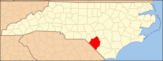
- Formed 1787
- Parent county / earlier Bladen
- County seat Lumberton
- Neighbors Bladen, Columbus, Scotland, Hoke, Cumberland
Photos & maps
What’s new
- Deepened hub: Coastal plain multi-community research (including Lumbee-associated neighborhoods) under Bladen parent.
- Formation 1787 from Bladen — for pre-formation events, use the parent jurisdiction’s paper (not later Anson-only catalogs).
- Seat: Lumberton · Neighbors: Bladen, Columbus, Scotland, Hoke, Cumberland.
- Long-form topics: research path, parents/formation, neighbors, places, record stack.
- Tools: checklist · this week in Robeson history.
Robeson County was formed in 1787 from Bladen. The county seat is Lumberton. Neighboring counties include Bladen, Columbus, Scotland, Hoke, Cumberland.
This hub combines a modern research floor—record matrix, towns, repositories, news—with local history narrative. For events before the county’s formation year, open the parent jurisdiction that owned that year—not a later statewide vital series or Anson-only catalog.
Robeson County was formed in 1787 from parts of Bladen County. The earliest settlers had arrived as early as 1747. The county was named for Col. Thomas Robeson who gained fame in September 1781 during the battle of Elizabethtown in the Revolutionary War. During the Battle of Elizabethtown, he and 70 colonials had defeated 400 loyalists. Lumberton is the County seat of Robeson County. Robeson County is also home to the Lumbee indians. The Lumbee are the largest tribal nation east of the Mississippi River and the largest non-reservation tribe in the United States. Among the Lumbee communities are: Prospect, New Hope, Back Swamp, Pembroke, Saddletree, Raft Swamp, Deep Branch, Union Chapel, Evan's Cross Roads, and Red Banks.
According to archaeological research this area has been before and after European colonization on this continent a meeting place of sorts in the Lumber (or Lumbee) River Basin. Pottery and goods from many tribes from before the colonial period as well as Spanish, French and English items worked there way into this area long before the first permanent European settlements in this area of North Carolina. The Waccamaw Indians were reported having a village near the Lumbee River early during the European exploration of this area.
Due to the effects of the Yamasee War and the Tuscarora War, the Waccamaw Indians had left what is now South Carolina. Lumbee oral tradition maintains that they were descended from Souian peoples such as the Cheraw and Keyauwee, also among these would be the Eno, Shakori, Waccamaw and Cape Fear Indeans.
The Lumber River was previously known (at least portions of it) as Drowning Creek. The Civil War saw the rise of Henry Berry Lowrie's War on Robeson County for about 10 years. Robeson is also known for the Battle of Hayes Pond in the town of Maxton in 1958 when armed Lumbee indians ran off about 50 ku klux klan members.
Gaelic was the official language early in this county's history due to the many highland scots that migrated to this area.
Archaeological excavation performed in Robeson County reveals a long and rich history since the end of the last Ice Age of widespread, continuous occupation of the region by various cultures of indigenous peoples. They had camps and settlements near the Lumber River for its water, transportation, fish and related resources. Local excavations reveal that Native American peoples made stone tools using materials brought to present-day Robeson County from the Carolina Piedmont. The large amounts of ancient pottery found at some Robeson County sites have been dated to the early Woodland period. Materials show that local settlements were part of an extensive Native American trade network with other regions. Portions of the river basin show that Robeson County was a "zone of cultural interactions."
Swamps, streams, and artesian wells provided an excellent supply of water for Native peoples. Fish was plentiful, and the region's lush vegetation included numerous food crops. "Carolina bays" continue to dot the landscape. Numerous 10,000-year-old Clovis points found along their banks indicate indigenous peoples used these depressions as campsites.
After colonial contact, European-made items, such as kaolin tobacco pipes, were traded by the Spanish, French, and English to Native American peoples of the coastal region. The coastal peoples traded with those further inland. Remnants of European goods have been dated prior to permanent European settlements along the Lumber River.
Changes during colonial era
Early written sources specific to the Robeson County region are few for the post-contact period of European colonization. In 1725, surveyors for the Wineau factory charted a village of Waccamaw Indians on the Lumber River, a few miles west of the present-day town of Pembroke. In 1754, North Carolina Governor Arthur Dobbs received a report from his agent, Col. Rutherford, head of a Bladen County militia, that a "mixed crew" of 50 families were living along Drowning Creek. The communication also reported the shooting of a surveyor who entered the area "to view vacant lands." These are the first written accounts about the Native peoples from whom the Lumbee claim descent.
Bladen County encompassed a portion of what is today Robeson County. English colonials named the river "Drowning Creek". After the violent upheavals of the Yamasee War of 1715-1717, and the Tuscarora War of 1711-1715, families of Algonquian Waccamaw left South Carolina Colony in 1718. They may have established a village west of present-day Pembroke, North Carolina by 1725. The "mixed crew" that Rutherford observed in 1754 were located in the same locale as the earlier Waccamaw settlement.
Anthropologist John R. Swanton of the Smithsonian Institution tried to identify the origin of the people known as Croatan Indians before the 1950s and now known as the Lumbee. Swanton posited that the people were the descendants of Siouan-speaking peoples, of which the most prominent in the area were the Cheraw and Keyauwee. They were not his major area of study, however, and some of his findings have been superseded by more recent evidence. The descent from Cheraw peoples is part of the Lumbee oral tradition, as well as a basis of their campaign for federal recognition as a tribe. In addition, they suggest that Native American refugees of other tribes, such as Tuscarora, gathered in the Robeson County area and merged as a people in the early nineteenth century.
By the mid-eighteenth century, migrants entered the frontier area from Virginia. In the 1790-1810 censuses, descendants of these families were classified as both white (European American) and free people of color, which could include people of full and partial African and Native American descent, as well as combinations of the three. They held few slaves. Late 20th-century researchers have traced 80 percent of the free people of color in North Carolina listed in those early censuses to African Americans free in Virginia in colonial times. The families were mostly descended from white women (which is what gave them free status so early) and men who were African or African American. In addition, some African male slaves had been freed in Virginia as early as the mid-17th century. They founded free families of several generations before migrating to other areas. In the early years of the southern colonies, working-class whites and Africans lived and worked closely together, marrying and forming unions. Many free people of color migrated to frontier areas to gain relief from the racial strictures of the coastal areas.
Other settlers often identified mixed-race people as Indian, Portuguese or Arab, in attempts to classify them. They sometimes self-identified as Indian as well, trying to escape from racial segregation. Some likely intermarried with refugee Indians who remained in the area after the populations were dramatically reduced due to infectious disease, war, migration and social dislocation. Names on early land deeds and other historic documents in Robeson County correspond to many of the free people of color, including ancestors of contemporary Lumbee. Settlements included Prospect and Red Banks.
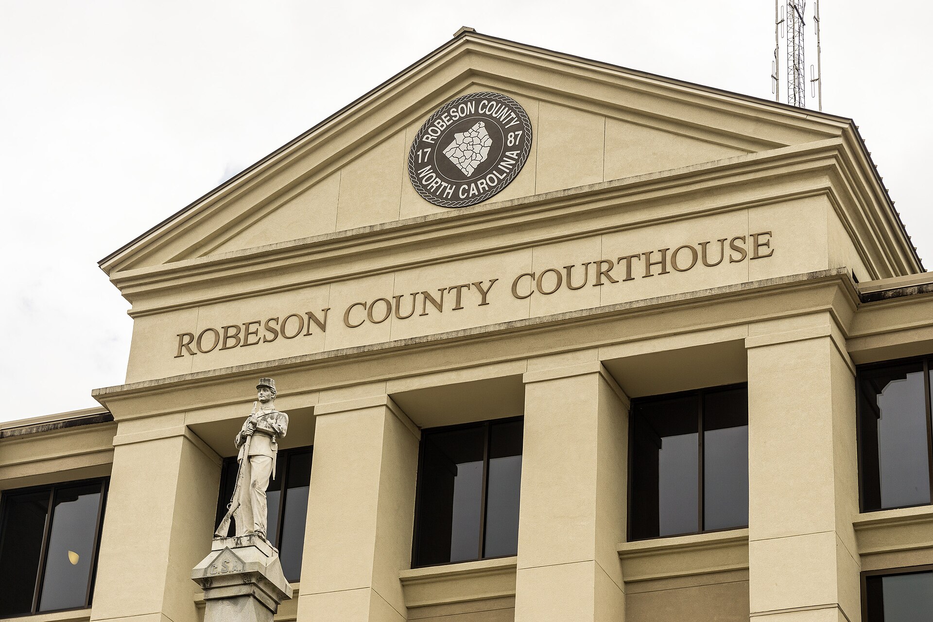
By the late eighteenth century, settlement patterns shifted. Ancestral Lumbee settlements were interspersed among faster growing white communities, and the name of the region's river was changed again. A lottery was used to dispose of lots with which to establish Lumberton. The town was later incorporated in 1788, and John Willis proposed the name "Lumberton" for the site, named for the lumber and naval stores industry that began to dominate, and continued to dominate the economy of Robeson County throughout the nineteenth century. The section of the Lumber River where Lumberton is located was known throughout that century as "Drowning Creek," a name by which the upper headwater portions of the river are still known. The first Robeson County courthouse was erected on land which formed a part of the "Red Bluff Plantation", owned by Lumberton founder, John Willis. Robeson County's post office was established in 1794.
In 1809, the state legislature renamed Drowning Creek the Lumber River, after the area's major industry. From the end of the eighteenth to the mid-nineteenth centuries, numerous languages could be heard throughout Robeson County: English and possibly remnant Siouan, Algonkian, and Iroquoian languages, although it is likely Native American languages disappeared before mid-century.
The Civil War
By the beginning of the American Civil War, most Native Americans attempted to eke out an impoverished existence. Their status continued to decline. Since 1790, Native Americans in the southern states were enumerated as "free persons of color" on the local and federal census. By 1835, and in the wake of the convergence of three historical events, Nat Turner's Rebellion, the ratification of the North Carolina Constitutional Convention, and Indian removal, they were stripped of their previously held right to vote, serve on juries, own and use firearms, and to learn to read and write. Many tribes in the east lost control of their traditional lands. Native Americans who stayed tended to live in frontier and marginal areas to avoid white supervision.
Henry Berry Lowrie
North Carolina seceded from the Union in 1861. A major yellow fever epidemic in 1862 killed 10 percent of the Cape Fear region's population. Most white men of military age either enlisted with the Confederacy or fled the region. The Confederate Army conscripted Indians and African-American slaves as workers to build a system of forts intended to defend Fort Fisher, near Wilmington, North Carolina. John C. Gorman, North Carolina's adjutant general, noted in his reports that Robeson County's conscription of several years' duration especially impacted, "Scuffletown [which] was included in the impressment and almost ever able-bodied male in the [Indian] settlements was dragged from home and railroaded to the coast." Pembroke was then known as "Scuffletown." Three of the "able-bodied" Indians have been documented as cousins of Henry Berry Lowrie. After they escaped from Fort Fisher, a member of Robeson County's home guard militia killed them as deserters.
Late in the Civil War, General William Tecumseh Sherman and his army began to push their way toward Robeson County as they proceeded from South Carolina. After his army sacked and burned Columbia on February 17, 1865, residents of Robeson County worried about the troops' advance. Washington Chaffin, a Methodist minister in Lumberton speculated in his diary about how the county might be treated by Sherman and his Yankees. Chaffin noted that Henry Berry Lowrie and his gang, saying they were "doing much mischief in this country." Lowrie's gang had "torn up and destroyed" white homesteads.
Robeson County's home guard, which included county magistrates, clergymen, and lawyers, who mainly represented the interests of the planter class (large slaveholders were exempted from participation in the army), raided the farmstead of Allen Lowrie, Henry Berry Lowrie's father. Not finding the younger Lowrie, they killed Allen and another son William in the confrontation. Henry Lowrie swore revenge. Two days after Allen and William Lowrie's funeral, local Indian guides helped Sherman's army cross the Lumber River through torrential rains into North Carolina. According to Sherman, the trek across the Lumber River and through the swamps, pocosins, and creeks of Robeson County "was the damnest marching I ever saw." During the next seven years, Henry Lowrie led a group of Lumbee ancestors and poor whites and blacks in an insurgent movement against the white establishment. His activities made him a folk hero to the Indians and other folk.
Source: Wikipedia.
Robeson County is served by the Lumberton Times
Tax Records
In-depth topics
Towns & communities
History notes
Robeson County (formed 1787 from Bladen; seat Lumberton) is a research problem defined by Coastal plain multi-community research (including Lumbee-associated neighborhoods) under Bladen parent. The modern label helps late sources and misleads when the event year sat in a parent courthouse.
Jurisdiction first. Write person + event + year + place as written in a source, then open the jurisdiction that owned that year. Before 1787, expect parent paper—not a Robeson-only catalog search.
Place density differs. Lumberton and market towns generate directories, newspapers, and church clusters that rural neighborhoods do not. Treat Lumberton, Pembroke, Red Springs, Fairmont, Maxton as separate paper systems sharing a courthouse label.
FAN clubs spill. Neighbor research regularly includes Bladen, Columbus, Scotland, Hoke, Cumberland. Abstract adjoining owners, witnesses, bondsmen, and three neighboring census households before you declare a negative search.
Special Robeson trap: Bladen parent; multi-ethnic community paper; tobacco/farm decades; Hoke/Scotland borders. Keep a one-page formation log (event year → jurisdiction tried → repository → result → next action).
Session order: (1) fix jurisdiction; (2) rebuild every federal census decade; (3) land + probate with full witness abstracting; (4) church/cemetery/newspaper; (5) military and institutional series; (6) paid databases last. Methods: Start here · Master guide · Counties & formation.
Record availability matrix
| Record type | Coverage | Years (approx.) | Notes |
|---|---|---|---|
| Federal census | good | 1790–1950 | Federal schedules after formation; identity and racial categories shift by decade—read instructions and local context, do not force modern labels backward. |
| Birth records | sparse | 1913– | Late civil; church and community substitutes critical earlier. |
| Marriage records | partial | 1787– | Civil improves later; earlier church/bond and community sources. |
| Death records | partial | 1913– | Certificates denser after statewide registration; church and obituaries earlier. |
| Land & deeds | good | 1787– | Record-loss / thin-series note: Formed 1787 from Bladen: Lumbee and multi-ethnic research trails; civil series alone under-serve. Pair courthouse work with church, school, and oral/community sources ethically and carefully. Post-1787 deeds; pre-formation Bladen. Abstract neighbors; land may sit under changing community labels. |
| Probate & estates | good | 1787– | Record-loss / thin-series note: Formed 1787 from Bladen: Lumbee and multi-ethnic research trails; civil series alone under-serve. Pair courthouse work with church, school, and oral/community sources ethically and carefully. Estates after formation; earlier Bladen. Not all families left formal probate—use tax, land, and church substitutes. |
| Church & parish | partial | varies | Church coverage varies by denomination and survival. Baptisms, membership, and burial registers often beat early civil vitals; check local societies and denominational archives. |
| Newspapers | varies | varies | Lumberton and local papers—verify DigitalNC. Regional Cape Fear titles for notices. |
| Military | good | 1775– | Revolutionary through 20th-century service may generate pensions, CMSRs, militia notes, and wartime claims. Pair unit research with Robeson place context and neighboring counties when companies recruited across lines. |
| Cemeteries | partial | varies | Published surveys, Find a Grave, churchyards, and family plots. Unmarked burials are common—use obituaries, church books, and land descriptions. |
| Court records | partial | 1787– | Common pleas, sessions, and other court series often begin near formation (1787); equity may sit with or near probate. Pre-1787 under Bladen. Known disruption: No major fire on standard lists; Bladen parent (1787); multi-community geography. |
| Tax lists | sparse | varies | Tax lists can substitute for missing census years and thin deed decades. Coverage is uneven by locality and year—check State Archives of North Carolina and published abstracts. |
Newspapers
Cemeteries & burial research
- Lumberton historic municipal & community cemeteries
- Robeson County cemeteries (Find a Grave / surveys)
Societies & repositories
Vital records
North Carolina statewide vital registration expanded in the early 20th century. For many Robeson County families you will rely on marriage bonds, church registers, Bible records, newspapers, delayed births, and probate—not only a modern certificate.
Research starting points
Courthouse & contacts
The county seat is Lumberton. Confirm current Register of Deeds, Clerk of Superior Court, and library hours before visiting—offices move and digital portals change.
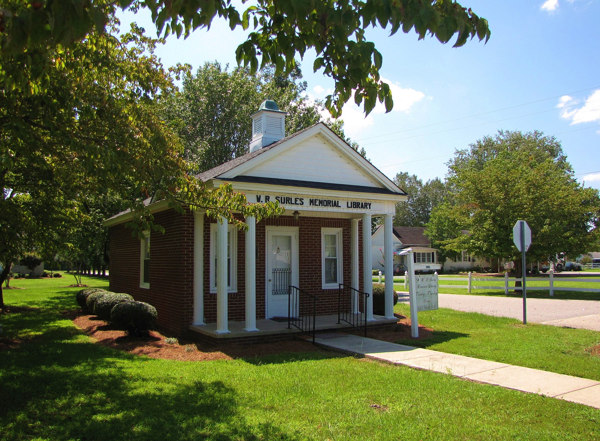
Public library: Robeson County Public Library
Record-loss / series note: Formed 1787 from Bladen: Lumbee and multi-ethnic research trails; civil series alone under-serve. Pair courthouse work with church, school, and oral/community sources ethically and carefully.
If not found here, try…
- Formed 1787
- Parent / earlier jurisdiction Bladen — check district-era records before this county existed (districts guide).
Neighboring counties (deeds, marriages, newspapers, and kin often cross the line):
Sources & further reading
- NCpedia — Robeson County
- David Leroy Corbitt, The Formation of the North Carolina Counties, 1663–1943
- William S. Powell, The North Carolina Gazetteer
- State Archives of North Carolina
- DigitalNC — Robeson County
- Chronicling America (Library of Congress)
- FamilySearch Wiki · NCGenWeb